


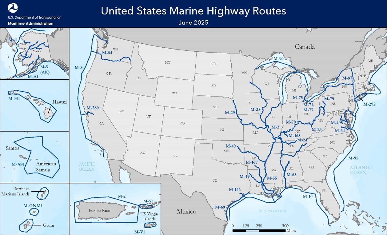
The USA’s transportation secretary Sean P. Duffy has confirmed that 848 miles (1,364.7 km) of navigable waterways will be added to the national network, supported by 14 new sponsors to the US Marine Highway Program (USMHP). The expansion brings the network to 27,139 miles (43,675 km) across 35 designated routes.
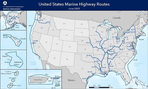
Major updates include strengthening the M-90 corridor through the Great Lakes, with new sponsorship from five state transportation departments: Wisconsin, Illinois, Minnesota, Michigan, and New York. Ports of Indiana and the Erie-Western Pennsylvania Port Authority are also supporting projects.
Newly designated routes include: M-23 on the Big Sandy River (20 miles, co-sponsored by Kentucky and West Virginia DOTs); M-24 on the Cumberland River (382 miles, co-sponsored by Kentucky and Tennessee); M-165 on Green River (109 miles, sponsored by Kentucky Transportation Cabinet); and the M-167 on the Ouachita River (337 miles co-sponsored by Louisiana DOT and Arkansas Waterways Commission).
The USMHP provides federal grants to eligible public and private projects to bolster supply chains, support infrastructure, and advance maritime workforce development.


