


Two developments highlight a growing drive for more reliable maritime data. OrbitMI has rolled out Vessel Reporting Analysis to help shipowners and operators understand how their vessel reports align with industry standards, while Kinéis is fast-tracking the expansion of its satellite AIS constellation on the back of fresh contract wins.

Maritime software provider OrbitMI has launched Vessel Reporting Analysis – a structured assessment designed to help shipowners and operators understand how closely their vessel reports align with industry vessel reporting standards.
The need for consistent, standards-aligned vessel reporting has grown significantly, it said, noting that small inconsistencies in noon reports can slow down compliance processes, create manual rework and weaken optimisation models. The Vessel Reporting Analysis gives operators a clear picture of where their reports stand and what adjustments will deliver the greatest impact.
“Standards matter more than ever,” said Alexandre Lapointe, chief product officer at OrbitMI, and the tool provides a review of noon reports, voyage data, fuel entries, and key operational fields; comparison of current reporting practices against the OVD standard; a summary of missing or inconsistent data; and recommendations to increase data quality and consistency.
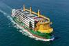
Meanwhile, with data integrity increasingly important in maritime logistics, Kinéis continues to accelerate the rollout of its satellite-based ship tracking solution. The product was first launched in June 2025 and this next stage of development follows the signing of two strategic contracts with data analytics firms Wood Mackenzie and Vortexa.
The International Maritime Organization (IMO) made ship tracking mandatory in 2001. However, according to Kinéis, AIS data collected through terrestrial infrastructure has limitations. The radio frequency signal emitted by ships covers less than 100 km, and some coastal areas remain unmonitored for geopolitical reasons.
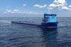
Unlike terrestrial AIS or other satellite AIS solutions, Kinéis said that its system has superior signal reception quality in dense areas. Thanks to its multi-beam antennas, it captures a significantly higher share of signals in congested maritime zones – such as the Gulf of Mexico, the Suez Canal, and the Persian Gulf – offering better performance than traditional satellites equipped with single-beam antennas.
“By integrating Kinéis’ high-performance S-AIS data with our existing AIS capabilities, we’re ensuring that Wood Mackenzie’s vesseltracker.com delivers industry-leading intelligence—empowering our clients in the maritime and commodity analytics sectors with the insights they require to make better decisions”, said Dallas Smith, Wood Mackenzie senior vice president, maritime.
Fabio Kuhn, founder and ceo of Vortexa, added: “We continuously enhance our database by integrating the world’s best satellite and terrestrial AIS sources. The Kinéis constellation adds a new dimension to our global coverage, strengthening Vortexa’s real-time and predictive analytics capabilities across energy and freight markets.”